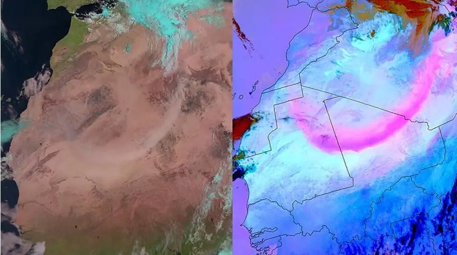
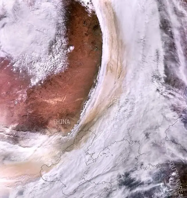
Whether we like it or not, dust is an indispensable part of our atmosphere and, for some ecosystems, a useful life-nurturing ingredient. For example, entire algae populations depend on windblown dust from the Sahara desert as it carries vital nutrients; in turn, other marine species depend on algae as their food source.
For humans, however, dust storms pose a serious danger, and while we cannot (and should not) eliminate them, it’s important to analyze how they originate and spread. A timely warning about coming storms can help prevent road accidents, save lives, and minimize harmful bacteria spread. Today, Earth observation satellite data provides valuable information about many terrestrial processes, dust storms included. Below, we will quickly explain their causes and hazards, list the benefits and limitations of satellite data for dust monitoring, and discuss the technology’s future potential.
Dust Storm Causes and Hazards
According to satellite data, human activity is, in part, a cause for increased dust storms — but only in part. Deforestation, as well as expansion of tilled agricultural fields and livestock pastures, do cause soil erosion, which, in turn, increases the likelihood of dust storms. However, strong winds caused by natural processes in our planet’s atmosphere would happen anyway, regardless of our livestock grazing. The main problem is that more soil erosion, as the result of commercial farming and urbanization, leads to more soil degradation — so we’re running in vicious circles.
Next, excessive amounts of wind-blown dust particles in our atmosphere can either reflect light (causing temperatures to cool down) or absorb it (causing them to rise). This further accelerates climate change, causing more challenges for many processes back on Earth, including farming.
Besides, as satellite data shows, dust storms may happen very suddenly, which seriously endangers road situations and causes major accidents. Finally, small windblown particles may carry bacteria — and while the human fatality rate due to inhaling them is extremely low, long-term exposure to dust causes serious respiratory issues, especially in children and people already affected by asthma and other respiratory diseases.
All of these hazards call for constant monitoring and, if possible, an early warning system to shield the population from harmful effects. But how is satellite data used for tracking dust storms and their effects?

How are dust storms monitored?
Traditional methods include ground-based observation stations and meteorological data analysis. However, both are rather limited as far as area coverage is concerned. Satellite data, even though not without its limitations, is a better solution because it provides vaster coverage and real-time monitoring.
But how can dust storms be seen from space? Aren’t dust particles blocking the view from above? They do, but satellite cameras are often equipped with infrared sensors that can capture detailed images regardless of light or atmospheric conditions. NASA’s Moderate Resolution Imaging Spectroradiometer (MODIS) is one example, providing detailed satellite data for air pollution mapping, climate change monitoring, disaster response, and more.
More benefits of real-time satellite data for dust monitoring include:
- Possibility of early detection and warning because even ‘sudden’ storms aren’t entirely sudden and can be foreseen in advance;
- Analyzing past satellite data captured in the same area can help assess long-term environmental impact; potentially, this could help come up with solutions to alleviate future hazards;
- Post-storm data analysis, when combined with ground data from local health authorities, helps estimate medical risks for the population or even develop mitigating solutions.
However, despite these obvious benefits, there are still some limitations of analyzing satellite data images. First, there are simply not enough Earth monitoring satellites to ensure truly global coverage. While geospatial satellites can visit every spot on the planet twice a day, there are huge temporal gaps, aka revisit times.
Besides, analyzing satellite wind data has a large mistake margin because there can be multiple interpretations of image data. For example, it is not always possible to correctly determine how high dust parties are rising judging from satellite images alone. Besides, satellite image data makes it difficult to distinguish between natural dust and industrial pollution particles. But there is room for hope, as always.
Future potential of EO satellite data
In the last few years, we have witnessed a considerable increase in collaboration between the public and private space sectors, which also includes joint initiatives with satellite data companies. In fact, most of NASA’s recent innovations result from collaboration with private companies — a sort of space symbiosis that brings astonishing results.
But even without the private sector, space organizations understand the need to enhance dust monitoring capabilities using satellite data. NASA is already working on the Earth Surface Mineral Dust Source Investigation (EMIT), an upcoming mission that should analyze dust distribution using space spectroscopy and real-time satellite data.
Finally, the massive adoption of AI could solve current challenges in satellite data interpretation and analysis. Machine learning algorithms are growing increasingly good at predicting possible outcomes based on past data analysis. Together with increasing private-public initiatives and the introduction of new space missions, there is every reason to believe that satellite data on dust storms will, soon enough, become more advanced.
